Mercedes-Benz C-Class Manuals

Mercedes-Benz C-Class (W205) 2015 - 2021 Owners Manual: Map and compass

Map and compass overview

Map and compass

  1. Saves the current vehicle position
  2. Moves the map
  3. Selects the map orientation and map view
  4. Selects the function depending on the equipment:
    • Sends a hazard warning via Car-to-X.
    • Filters the display of POIs in the vicinity according to POI category
  5. Switches the display of personal POI symbols on the map on or off
  6. Switches one of the following displays on or off depending on the equipment:
    • Weather information
    • Satellite map
    • Traffic incidents
  7. Switches the traffic map display on or off

The map and satellite images are shown in globe projection. This allows for a realistic map display in all map scales. The map uses elevation modeling.

Depending on the map data, important buildings in many cities are depicted realistically on the map in small map scales (e.g. 1/32 mi (20 m), 1/16 mi (50 m) ). Other buildings are shown as models.

You can set the unit of measurement of the map scale.

If online information is available, fuel prices and the availability of parking spaces in parking garages are displayed, for example.

Requirements:

  • Mercedes me connect is available.
  • You have a user account for the Mercedes me portal.
  • The service has been activated at an authorized Mercedes-Benz Center.

Further information can be found at: http:// www.mercedes.me

The online information is not available in all countries.

If Display in COMAND is activated in Traffic Sign Assist, speed limits and overtaking restrictions are displayed on the map.

Company logos displayed on the map are trademarks of the respective companies and used solely for the purpose of indicating the locations of these companies. The use of such logos on the map does not indicate approval of, support of or advertising by these companies for the navigation system itself.

Setting the map scale

Requirements:

  • The map is shown.

Multimedia system: Navigation

  • To zoom in: swipe down on the Touch Control.

    or

  • Turn the controller counter-clockwise.

    or

  • Move two fingers apart on the touchpad.
  • To zoom out: swipe up on the Touch Control.

    or

  • Turn the controller clockwise.

    or

  • Move two fingers together on the touchpad.

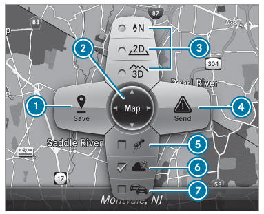
You can set the unit of measurement of the map scale.

Moving the map

Multimedia system: Navigation → Options → Map Menu

  • Alternatively, if the map is displayed in full screen mode, press the central control element.

    The map menu appears.

  • Select "Move map" in map menu 2.
  • Swipe in any direction on the Touch Control or touchpad.

    or

  • Slide the controller in any direction.

The map moves in the corresponding direction under the crosshair. The further you move your finger away from the starting position on the touchpad, the faster the map moves.

Selecting the map orientation

Multimedia system: Navigation → Options → Map Menu

  • Alternatively, if the map is displayed in full screen mode, press the central control element.

    The map menu appears.

  • In map menu 3 , select N, 2D or 3D.
    • N: the 2D map view is displayed so that north is always at the top.
    • 2D: the 2D map view is aligned to the direction of travel.
    • 3D: the 3D map view is aligned to the direction of travel.

Selecting POI symbols

Multimedia system: Navigation → Options → Map Content

POIs include gas stations and hotels which can be displayed as symbols on the map, for example.

Not all POIs are available everywhere.

  • Select POI Symbols.

    The dot indicates the current setting.

    Standard displays symbols of predefined categories on the map.

    User Defined allows you to personally select the symbols for the available categories.

    None switches the display off.

  • Select a setting.
  • User Defined: select categories.

    The POI symbols of the selected categories are displayed or not displayed .

Selecting the display of text information in the map

Multimedia system: Navigation → Options → Text Information

  • Select text information.

    Current Street shows the street you are currently driving on at the bottom of the display.

    When the map is moved, the following information appears under the crosshair:

    • Street name
    • POI name
    • Area name

Geo-coordinates displays the following information:

  • Longitude and latitude
  • Elevation
    The elevation shown may deviate from the actual elevation.
  • Number of satellites from which a signal can be received
    When the map is moved, this information does not appear.

Climate Control displays the current climate control settings.

None switches the display off.

Displaying the next intersecting street

Requirements:

  • Route guidance is not active.

Multimedia system: Navigation → Options

  • Activate Next Intersecting Street.

    The name of the next intersecting street will be displayed at the upper edge of the display.

Displaying the map version

Multimedia system: Navigation → Options

  • Select Map Version.
  • Select Details.

Information about new versions of the digital map can be obtained from an authorized Mercedes-Benz Center.

Overview of avoiding an area

You can define areas along a route that you would like to avoid.

The route can include an area that is to be avoided in the following situations:

  • the destination is located in an area that is to be avoided
  • if freeways are located within the area that is to be avoided
    Freeways are always taken into account for the route.
  • there is no sensible alternative route

Avoiding a new area

Multimedia system: Navigation → Route and Position → Avoid Options → Areas

  • Select Avoid New Area.
  • To search for an area via the map: select Using Map.
  • Move the map or
  • To search for an area using an address: select Address Entry.
  • Enter the address.
  • Select Select Destination.

    The map appears.

  • To display an area: press the Touch Control, the touchpad or the controller.

    A red rectangle appears. This designates the area that should be avoided.

  • To change the size of the area: swipe up or down on the Touch Control or the touchpad.

    or

  • Slide the controller up or down.

    The map scale is enlarged or reduced and changes the size of the area.

  • To set the area: press the Touch Control, the touchpad or the controller.

    The area is entered into the list.

Changing an area

Multimedia system: Navigation → Route and Position → Avoid Options → Areas

  • Highlight an area in the list.
  • Select Edit.

Moving the area on the map

  • Swipe in any direction on the Touch Control or touchpad.

    or

  • Slide the controller in any direction.

Changing the size of the area

  • To start: press the Touch Control, the touchpad or the controller.
  • To change: swipe up or down on the Touch Control or the touchpad.

    or

  • Slide the controller up or down.
  • To stop: press the Touch Control, the touchpad or the controller.

Taking the area for the route into account

  • Avoid an area in the list.

    If route guidance is active, a new route is calculated.

    If there is no route yet, the setting is carried over to the next route guidance.

Deleting one or all areas

Multimedia system: Navigation → Route and Position → Avoid Options → Areas

  • Highlight an area in the list.
  • Select Delete or Delete All.
  • Confirm the prompt with Yes.

    One or all areas are deleted.

Map data update overview

Updating at the authorized Mercedes-Benz Center

The digital maps generated by the map software become outdated in the same way as conventional road maps. Optimal route guidance can only be provided by the navigation system in conjunction with the most up-to-date map data.

Information about new versions of the digital map can be obtained from an authorized Mercedes-Benz Center.

You can receive updates to the digital map there.

Online map update

The online map update service from Mercedes me connect can be used to update map data.

The online map update service is not available in all countries.

The following options are available for the update:

  • the automatic map update updates map data for one region.

    For automatic map updates Automatic Online Update must be activated in the system settings.

  • the manual map update updates map data for several or all regions.

Further information on the online map update is available at an authorized Mercedes-Benz Center or at http://www.mercedes.me.

Further information on updates: http:// manuals.daimler.com/baix/cars/connectme/ en_GB/index.html.

Overview of map data

Your vehicle is supplied with map data at the factory.

Depending on the country, map data for your region is either pre-installed or the map data is supplied on a data storage medium.

If the map data on your vehicle has been installed at the factory and you wish to reinstall it, you do not need to enter the activation code.

For map data that you have purchased in the form of a data storage medium, you must enter the accompanying activation code.

If you save the map data on a data storage medium with the online map update service, no entry is required. The activation code is stored on the data storage medium during the downloading process.

Observe the following when entering the activation code:

  • The activation code can be used for one vehicle
  • The activation code is not transferable
  • The activation code has six digits

In the event of the following problems, please contact an authorized Mercedes-Benz Center:

  • The multimedia system does not accept the activation code
  • You have lost the activation code

Displaying the compass

Multimedia system: Navigation →  Route and Position

  • Select Compass.

    The compass display shows the following information:

    • the current direction of travel with bearing (360º format) and compass direction
    • longitude and latitude coordinates in degrees, minutes and seconds
    • height (rounded)
    • number of GPS satellites from which a signal can be received

Setting the map scale automatically

Multimedia system: Navigation → Options

The map scale is set automatically depending on your driving speed.

For journeys in cities with detailed city models, a map view from the driver's perspective is used.

  • Switch Auto Zoom on or off .

The automatically selected map scale can be changed manually for a short time. The setting is reset automatically after a few seconds.

Displaying the satellite map

Multimedia system: Navigation →  Options →  Map Content

  • Switch Satellite Map on or off .

    or

  • If satellite map display 6 is available in the map menu, switch it on or off .

    Switched on : satellite maps are displayed in map scales of 2 mi (2 km) or less.

    Switched off : satellite maps are not displayed in map scales from 2 mi (2 km) to 10 mi (10 km).

Satellite maps for these map scales are not available in all countries.

Displaying weather information

Requirements:

  • Mercedes me connect is available.
  • You have a user account for the Mercedes me portal.
  • The service is available.
  • The service has been activated at an authorized Mercedes-Benz Center.

Further information can be found at: http:// www.mercedes.me

Multimedia system: Navigation → Options → Map Content

  • Activate Weather Information .

    or

  • If weather information display 6 is available in the map menu, activate it.

    Current weather information is displayed on the navigation map, e.g. temperature or cloud cover.

Weather information is not available in all countries.

    Route guidance with current traffic reports

    Telephone

    See More:

    Mercedes Benz C-Class (W204) 2007 - 2014 Training Manual > Emergency Operations: Manually operating the tilting/sliding roof or panoramic tilting/sliding roof
    The drive is located above the overhead control panel. Pull the mirror base cover 1 down as far as possible and turn it to the side. Legend Mirror base cover Insert a thin plastic plate 1 in the rear end of the overhead control panel 2 in the center of the gap between the headliner and overhead cont ...

    Mercedes-Benz C-Class (W205) 2015 - 2021 Owners Manual

    Mercedes Benz C-Class (W204) 2007 - 2014 Training Manual

    © 2024 Copyright www.mersec.net
    0.0068